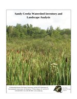
Sandy Creeks Watershed Inventory and Landscape Analysis
Project Sponsor: New York State Tug Hill Commission
End Date: Jan. 31, 2011
Summary
The purpose of this project was to provide the NYS Tug Hill Commission and its communities with a clearer picture of the biodiversity and ecological patterns of the 284,000-acre Sandy Creeks Watershed. We wished to help identify natural areas in the watershed that are vital to protecting the landscape character and biodiversity of the region including the relative ecological quality of subwatersheds.

There were four phases to this project: 1. Develop a list of rare species and natural communities known from or with the potential to be found in the Black River and Sandy Creeks watersheds and create their corresponding Element Distribution Models (EDMs); 2. Overlay the EDMs and note where multiple species overlapped, indicating a potential biodiversity “hotspot” in the Black River and Sandy Creeks Watershed; 3. Analyze the quality of the subwatersheds using a suite of GIS layers in the Sandy Creeks Watershed; and 4. Conduct field inventories and document locations of rare plants, rare animals, and significant natural communities in the Sandy Creeks Watershed.
Citation: Swift, L., J. Corser, R. Ring, J. Schmid, T. Howard, E. Spencer. 2011. Sandy Creeks Watershed Inventory and Landscape Analysis. A report prepared for the NYS Tug Hill Commission. New York Natural Heritage Program. Albany NY. 114 pages.
Jan. 15, 2021 | Updated Feb. 5, 2021, 8:43 a.m.